Activities:
Country Walks in Skopelos

Country Walks in Skopelos
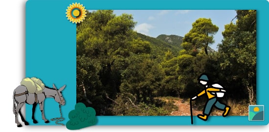
Country Walks and Hiking in Skopelos have evolved over the past decades.
Back in the date when the words “car” and “asphalt” could not be found in many dictionaries, transportation was done through completely different means: walking or donkey riding!
The locals had created a whole network of footpaths, which led them from the southernmost to the northernmost point of Skopelos or from an eastern to a western direction.The time needed to cross these paths varied.
It could take from 1 to 5 hrs, especially if they decided to stop along the way for a picnic.
A leisurely walk could also include socialising with the locals that happened to meet along a winding path.
This was a great way to find out about the happenings on the other end of the island or just gossip; remember, it was an era without many telephones around.
The era does not go back hundreds of years. The credits of this “documentary” roll up during the late ’70s and the beginning of the ’80s.
The first few cars appeared on Skopelos at that time.
The first paved car roads started to replace the footpaths leading to the main settlements of the island. Donkeys got replaced by cars and asphalted roads replaced or intersected the paths.
Most of the paths had, at some point, been neglected, erased or overgrown.
Today however there is a significant amount of effort has been put into clearing them.
Some of the tracks have seen a complete facelift in that they were rebuilt as old, stone paths.
Walking on these surfaces is a different experience and requires good hiking boots.
In some instances, a hiking stick would not be a bad companion either.
Once you arrive at the port of Skopelos, you will see a great areal map of Skopelos, highlighting the names and areas of the path network.
When walking through these paths, one can still hear the whispers and visualise the locals resting under the thick canopy of pine trees.
The area around Skopelos Country Villas has a lot of wonderful paths that you can follow. Some of these are more leisurely, and some others will satisfy the more demanding hiker.
An excellent app ideal for hikers around Skopelos is the ‘Avenza Maps’.
You can download your copy on either Google Play Store or Apple Store.
